

Jeri’s Steps: 26,070
Miles walked: 11.7
Elevation: 606
Pints: none (wine)
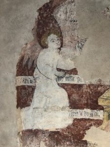
Churches: 1
Stiles: 6
Benches: 1
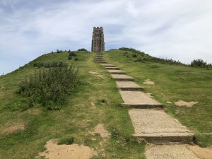
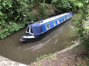
A shorter day today as we took the direct route across the peninsula to Padstow. The first section was over crop fields and cow pastures; the wheat was more compliant than the cows who were understandably nervous of us given their young calves. In St. Merryn we couldn’t ignore a cream tea sign, so we sat for half an hour trying to eat two scones each and a bucket of clotted cream, the theory being that because we are walking we can eat anything. Unfortunately the church was closed, but its position on the top of the hill was lovely. Soon we were in Padstow and it was as if we were engulfed by people. It was extremely busy, most people seeming to flock to the various Rick Stein establishments. We carried on to the south of the town to our campsite which has to be one of the best locations so far; next to the Camel Trail, overlooking the estuary. Later we walked into town and had…Italian. Yes, I know we could have gone to one of Stein’s places, but sometimes you just have to have pasta.
Download file for GPS
St Merryn 

Climbing with style, a stile 


Padstow 
Camel estuary 


3 Responses
Eat up!
So, you cut across to Harlyn and Trevone instead of going out to Dinas Head.
Interestingly, the South West Coast Path site says 10.6 miles via Dinas Head. Probably you walked at least an extra mile or two looking for scones and pints. Jeri’s steps seem to equate to the 11 miles.
Just wanted you to know I’m keeping careful track of your excursion. 😉
FYI, the number of steps isn’t a good indication of distance traveled. We’ve done some pretty impressive ups and downs and those take a lot of small steps!!